
What I especially like is the rhythm: hot spring town first, forest trail next, then a ridge and a view if the weather plays nice. If you’re learning Japanese, this is also a nice place to pick up real trail vocabulary you’ll actually remember.
Mt. Kamagatake: a compact climb with a big payoff
Did you know that Mt. Kamagatake in Mie Prefecture sits at 1,210 metres and is part of the Suzuka mountain range? It’s not one of those endless, all-day summit missions, which is exactly why it works so well as a practical Japan hiking trip. You can make it a focused half-day or full-day outing, depending on pace, weather, and how long you linger at the top.
Mt. Kamagatake is often written as Kamagatake, and the mountain has a strong local following because it combines forest, ridgeline views, and easy access from Yunoyama Onsen. For Japan fans, that mix is gold. You get the nature, the onsen atmosphere, and a route that feels grounded in everyday regional travel rather than tourist spectacle. Personally, that’s the kind of hike I always remember.
Here’s the catch: the mountain is approachable, but it still feels like a proper climb. That matters, because you won’t get the “theme park hike” feeling that some short trails have. You’ll be on real mountain paths, often damp, sometimes rocky, and always changing with the season. Sounds good, right?
Yunoyama Onsen: the best base for a Kamagatake day
Picture this: you finish a mountain walk, your legs are tired, and ten minutes later you’re soaking in an onsen. That’s the appeal of Yunoyama Onsen, the classic base for Mt. Kamagatake. The area is part of Komono Town in Mie, and it has long been known as a hot spring destination linked to mountain travel and relaxed weekend escapes.
No exaggeration: this is where the route becomes more than just a hike. A Yunoyama Onsen stay lets you turn the day into a proper Japanese mountain-and-bath experience. Many travellers combine the trail with a ryokan night, a simple meal, and a slow morning before heading back. If you’ve been studying words like onsen, ryokan, 山 (yama, mountain), and 道 (michi, road; path), this is the kind of place where they stop being textbook vocabulary and start feeling real.
Before I forget: the area is also convenient if you’re travelling through the Kansai and Mie region. You’re not deep in remote territory, but you still get that fresh air, cedar forest, and mountain silence that so many Japan lovers chase. My tip: if you can, go on a weekday. It’s calmer, and the trail atmosphere feels even more local. Simply brilliant.
Nagaishidani and Mitsuguchidani: choosing your Kamagatake route
Here’s the thing: the two most talked-about approaches are the Nagaishidani course and the Mitsuguchidani course, and both give you a different flavour of the mountain. If you like a more classic forest ascent, Nagaishidani is a solid choice. If you want a route that feels a little more direct from the Yunoyama area, Mitsuguchidani is often the name people look for.
Nagaishidani course
The Nagaishidani course is a well-known path for Mt. Kamagatake hikers, and it has that nice old-school mountain feel. Expect steady climbing, tree cover, and sections where the trail asks you to pay attention. It’s the sort of route where you hear your own footsteps, then suddenly notice bird calls, water sounds, and the smell of wet earth. Wait, there’s more. The path can feel especially atmospheric after rain, though that also means you’ll want proper shoes.
For example, if you’re used to casual city walks in Japan, this trail will feel like a real step up in effort. That’s not a bad thing. It just means you should bring water, snacks, and enough time. A round trip can easily become a half-day project once you factor in breaks and summit time.
Mitsuguchidani course
The Mitsuguchidani course is another popular access route, and many hikers appreciate it for its straightforward mountain approach from the Yunoyama side. It’s a good option if you want a route that keeps the focus on getting you into the alpine feel quickly. The best part: both routes keep you close enough to civilisation that you can enjoy the comfort of Yunoyama Onsen afterwards without any complicated logistics.
Plot twist: the route choice can matter more than the summit itself. On a clear day, both paths set you up for a satisfying nature outing, but the experience changes with season, rain, and pace. In spring, fresh green leaves brighten the forest. In autumn, the slopes can feel fiery with colour. In winter, conditions can shift quickly, so check local access and bring gear that matches the day. Personally...
What to expect on the trail, and a few Japan-language notes
Ever wondered why Japanese hikers feel so efficient about mountain trips? Part of it is preparation, and part of it is that the trail culture is very practical. You’ll often hear words like 登山 (tozan, mountaineering; mountain climbing) for mountaineering, 渓谷 (keikoku, valley; gorge) for valley, and てっぺん (teppen, summit; top) for summit in casual conversation. Even on a small mountain day, people plan carefully, respect weather changes, and keep their rubbish with them. That’s not just etiquette, it’s part of the whole rhythm of hiking in Japan.
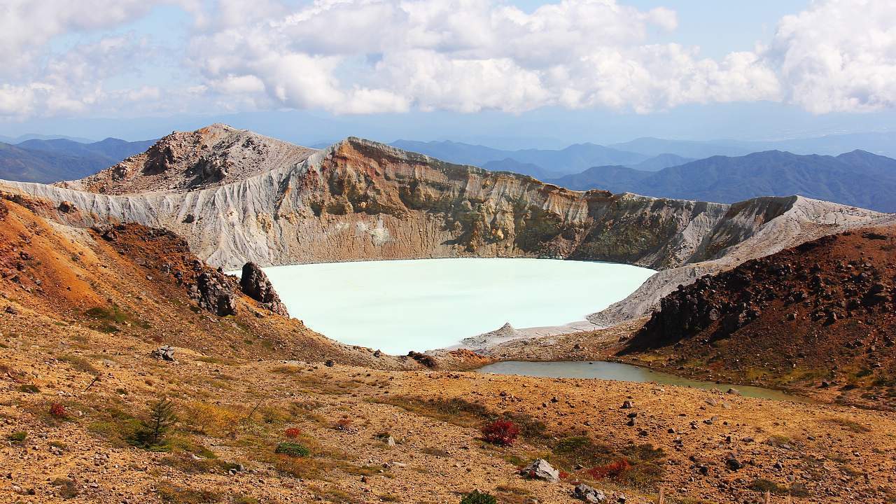
On Mt. Kamagatake, expect a mix of forest shade, rocky sections, and summit views that make the effort worthwhile. You’re in the Suzuka range, so the scenery has that layered mountain feel, especially when the light is soft. If visibility is good, the horizon opens up nicely, and the contrast with the hot spring town below is a big part of the appeal.
Insider tip: bring a small towel for the onsen afterwards, and keep a light change of clothes in your bag. If you’re also learning Japanese, this is a good chance to practise useful phrases like すみません (sumimasen, excuse me; sorry), お願いします (onegaishimasu, please; I'd like to ask a favor), and arigato in a real travel setting. You’ll hear them everywhere in inns, shops, and station areas. That’s the kind of language practice that sticks. Sounds good, right?
What I especially like about this hike is how neatly it combines three things: a solid mountain, a classic onsen town, and route choices that feel accessible without being boring. Mt. Kamagatake isn’t trying to be flashy. It’s simply a strong local mountain day, and that makes it a hidden gem for Japan fans who want something authentic. If you’re planning a Mie trip, this one deserves a spot near the top of the list.
Frequently Asked Questions
How difficult is the Mt. Kamagatake hike?
It is a moderate mountain hike with real climbing sections, so basic fitness and proper footwear are recommended.
Can I combine the hike with a hot spring visit?
Yes, Yunoyama Onsen is the natural base, and many hikers finish with a bath or an overnight stay.
Which route is better, Nagaishidani or Mitsuguchidani?
Both are popular, and the better choice depends on your pace, conditions, and where you want to start from.