That mix matters for anyone planning a Hokkaido trip, and it also gives Japanese learners a neat set of place-based words to hold onto: 平 (Taira) for plains, onsen for hot springs, and 山 (yama) for mountains, all doing ordinary work in an unusually spacious setting.
Tokachi, Hokkaido's wide east side
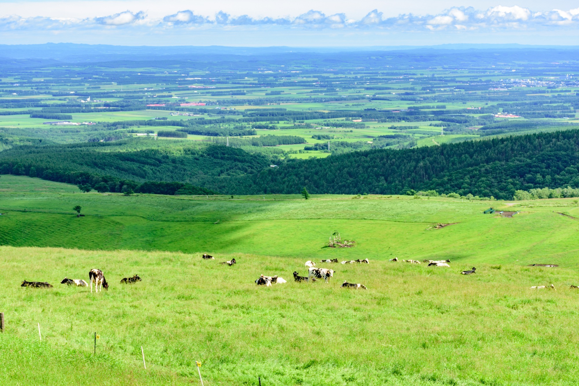
Tokachi is the eastern stretch of Hokkaido around Obihiro, and the first thing to understand is scale. The area is built around plains, agriculture, and long road distances, not compact sightseeing loops. According to Visit Hokkaido, this is the kind of region where the land itself does most of the talking, which is exactly why it rewards slow travel.
For Japan fans, that texture of place matters. Tokachi feels like a word you can walk into: open fields, clear skies, and the kind of horizon that makes a day feel longer than it is. If you only know Hokkaido through Sapporo or ski resorts, Tokachi is the quieter counterweight. Less show. More breathing room. My tip: keep your itinerary light, because the region works better when you let the kilometres stack up naturally.
Pro tip: learn a few landscape words before you go. Taira means plain, onsen means hot spring, and yama means mountain. Tokachi gives you all three, and then some. That’s the point. See what I mean?
The Tokachi mountain range, fire and flowers
Here’s the thing: Tokachi isn’t only flat land. The Tokachi mountain range rises nearby, and the contrast is the story. One source, YuYaアウトドア旅~Outdoor Journey~, notes that the volcanic group runs in an almost straight line from southwest to northeast, including peaks such as Mt. Maefurano, Mt. Furano, Mt. Kamihokamettoku, Mt. Tokachi, Mt. Biei, and Mt. Bieifuji. That alignment helps explain why the area can feel like two landscapes sharing the same frame.
A good example: the mountains are often described in two moods, one floral and one fiery. The flower side is the softer one, with alpine plants and summer colour. The fire side is the volcanic one, with active geology that gives the range its raw shape. To be fair, this is the sort of detail that sounds abstract until you stand in front of it. Then it lands hard.
For learners, this is a nice place to pick up the Japanese habit of naming terrain very directly. 草花 (Kusahana) for flowers, 火山 (kazan) for volcano, and 前進 (zenshin, advance) for a sense of forward movement through space, even when the walking is slow. Not poetic, exactly. Precise. Much better.

Obihiro, Tokachi-Obihiro Airport, and getting around
Guess what? Tokachi is easier to reach than many people assume, because Obihiro has an airport and a practical transport base. Tokachi-Obihiro Airport is a midsized airport in Hokkaido, located at latitude 42.73330 and longitude 143.21700, with one runway, 17/35. Its IATA code is OBO. That makes it a useful entry point for a region that’s otherwise best understood on road or rail by the time you start moving around.
On a related note, there is also Tokachi Airport, another midsized airport in Hokkaido, at latitude 42.89050 and longitude 143.15800, with two runways, 13/31 and 13L/31R. The naming can be a little clumsy if you’re skimming a map, so check carefully. That’s the sort of small administrative snag that can waste a day if you don’t slow down for thirty seconds and read properly. Us dorks should know better.
Obihiro itself is the sensible centre for food, lodging, and onward movement. If you’re building a Tokachi route, start there and fan out. Don’t overcomplicate it. The region is generous to travellers who keep their load modest and their schedule loose. More clicks, fewer assumptions.
Why Tokachi works for a slower Hokkaido trip
Imagine a narrow alley in Tokyo. Now replace it with farmland, a mountain horizon, and a road that seems to keep going because it can. That is Tokachi’s appeal, and it’s why the area suits travellers who care about the body as much as the checklist. Walking, driving, and pausing matter here, because the place is read in intervals, not in one dramatic glance.
That reminds me: Hokkaido often gets flattened into winter imagery, but Tokachi works in other seasons too. Spring and summer bring cleaner greens, autumn shifts the fields, and winter strips everything back. The result is a region with strong texture, not a fixed postcard. If you like reading Japan through land use, weather, and distance, this is my absolute hidden gem. Not hidden in the promotional sense, just overlooked by people who want the next obvious stop.
What I especially like is the balance. Tokachi gives you agriculture, volcanic drama, and an airport-based entry point without forcing the issue. You can arrive, look around, and move on at your own pace. That’s enough. From my experience...
Frequently Asked Questions
Where is Tokachi in Hokkaido?
Tokachi is in eastern Hokkaido, with Obihiro as its main hub and wide plains shaping much of the region.
Is Tokachi easy to visit without a car?
You can reach Obihiro by air, but getting around the wider area is easier if you plan carefully and keep your route simple.
What makes Tokachi worth adding to a Hokkaido trip?
It gives you open landscapes, volcanic mountains, and a slower pace that feels different from Hokkaido's better-known city and ski areas.